The Climate Lens Sharpens: OlmoEarth v1.1 and the Push for Leaner Planetary Intelligence

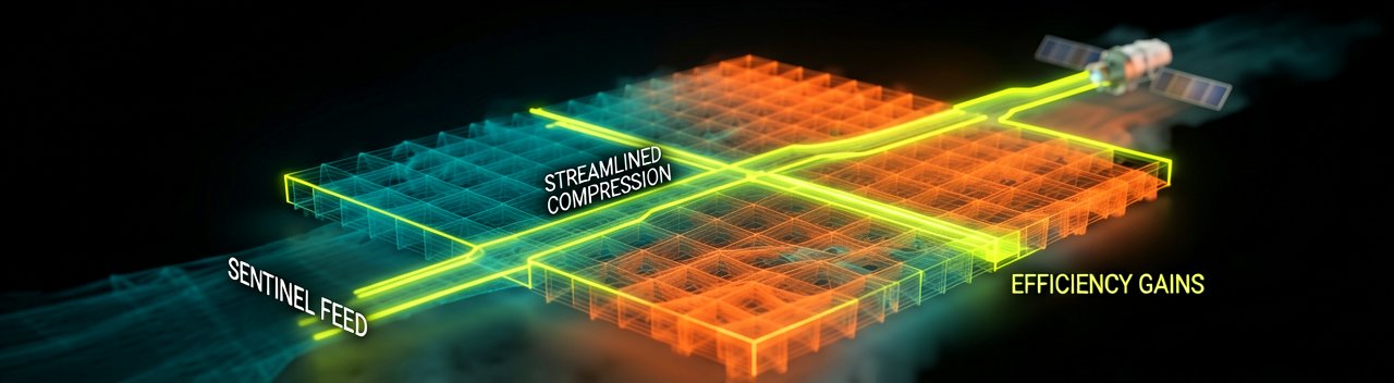
The Allen Institute for AI (Ai2) has never been one for half-measures when it comes to open science, and the release of OlmoEarth v1.1 feels like a calculated doubling down on that ethos. While the original version was already a heavy hitter in the remote sensing space, this latest iteration isn't about raw power—it is about the surgical refinement of efficiency. By optimizing how the model processes the massive, multi-modal streams of satellite data from Sentinel and Landsat, the Hugging Face blog reports that Ai2 has successfully slashed compute costs by up to 3x without sacrificing an ounce of performance. In a field where the "compute tax" often keeps high-end planetary monitoring behind a paywall, this shift toward leaner architectures is more than just a technical update; it’s a democratization of environmental oversight.
The Architecture of Restraint
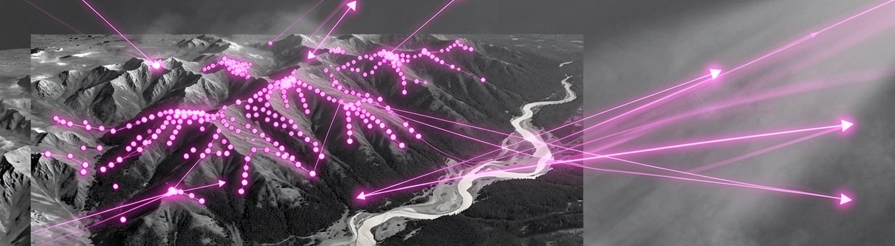
Technically, OlmoEarth v1.1 maintains the core spatio-temporal foundation of its predecessor but introduces critical tweaks to its "masked image modeling" recipe. The developers moved to single band sets per modality and updated both the masking and loss functions to prioritize high-value feature extraction over redundant processing. This refinement means the model can now digest 10 terabytes of global sensor data far more efficiently. According to the official technical report, these optimizations allow the model family—which ranges from the lightweight "Nano" variant to the robust "Large" version—to stay competitive against much larger commercial counterparts. It is a masterclass in getting more out of less, proving that in the race to map forest loss or crop yields, smart engineering often trumps brute-force scaling.
What Most Reports Miss: The Invisible Burden of Scale
Behind the Scenes: The true hurdle for planetary-scale AI isn't just the initial training of the model; it is the staggering cost of the "daily grind"—the continuous inference required to keep maps of the Amazon or the Sahel up to date. For an NGO or a small government agency, the difference between a model that runs on one GPU and one that requires a cluster is the difference between a one-off research project and a permanent early-warning system. By prioritizing a 3x reduction in compute, Ai2 is addressing the "last mile" problem of Earth observation. This isn't just a win for the green-tech sector’s carbon footprint; it is a direct response to feedback from early adopters who loved the accuracy of v1.0 but struggled with the infrastructure overhead of running it across entire continents.
Historically, the AI community has chased the "state-of-the-art" (SOTA) crown through sheer parameter count, but the remote sensing world operates on different physics. Satellite data is notoriously messy, multi-temporal, and heavy. The shift in v1.1 toward a more sophisticated masking strategy reflects a maturing understanding that foundation models for the Earth must be nimble enough to handle "low-resource" scenarios. Stakeholders from organizations like Wetlands International have noted that these efficiencies are what allow them to move from historical analysis to near real-time detection, effectively halving the time between a satellite pass and a usable insight. As highlighted by the Ai2 project page, this responsiveness is critical for managing fast-moving threats like wildfires or illegal deforestation.
Furthermore, the open-source nature of OlmoEarth v1.1 serves as a vital counterweight to the "black box" models emerging from the commercial sector. By providing the source code, training data, and weights, Ai2 allows the scientific community to audit the biases and failure modes of the system. This transparency is particularly crucial when the model's outputs are being used to drive policy decisions or carbon credit markets. A seasoned reporter would note that the "Artifact License" attached to these models is a strategic choice; it encourages wide use while maintaining a framework for responsible deployment. This balance of openness and efficiency ensures that the tools to protect the planet are not just powerful, but also practically accessible to the people who need them most.
Looking at the broader landscape, OlmoEarth v1.1 is part of a growing trend where "SOTA" is being redefined by utility rather than just benchmark scores. The ability to fine-tune these models with modest datasets allows local experts to adapt the AI to their specific geography—whether that's identifying mangrove species in Southeast Asia or mapping drought-resistant crops in East Africa. The efficiency gains in v1.1 make this iterative fine-tuning cycle faster and cheaper, lowering the barrier for entry into high-end geospatial analysis. It’s a clear signal that the next frontier of AI isn't just about building bigger brains, but about building more practical ones that can survive and thrive in the resource-constrained realities of global conservation.
The Efficiency Paradox and the Open Question of Impact
Reading Between the Lines: While the "3x compute reduction" headline makes for excellent PR, the cynical observer might wonder if we are simply getting better at doing the wrong things faster. The tech industry has a long history of Jevons Paradox—where increasing the efficiency of a resource leads to more, not less, of its consumption. In the case of OlmoEarth v1.1, making planetary monitoring cheaper might not just lower the barrier for NGOs; it could equally fuel a massive expansion in high-frequency data scraping that ultimately offsets the carbon savings Ai2 is touting. We are racing toward a world where every square meter of the Earth is indexed every hour, yet our collective ability to act on that data remains bogged down by the same old geopolitical inertia.
There is also a subtle contradiction in the push for "open science" within such a specialized niche. Ai2 is providing the weights and the code, but the raw fuel for these models—petabytes of satellite imagery—remains a logistical nightmare for the average researcher to handle. Even with a leaner model, the "democratization" claim hits a ceiling when you consider the massive cloud storage bills required to host the data being analyzed. We risk creating a tiered system where the tools are "free" but the environment required to run them remains a gated community, accessible only to those with existing institutional backing or deep-pocketed grants.
Furthermore, the technical pivot toward single-band sets per modality in v1.1, while brilliant for speed, forces a conversation about what is being left on the cutting room floor. In the quest for a more efficient "foundation," we may be smoothing over the edge cases and atmospheric noise that contain the very nuances needed for hyper-local climate adaptation. Efficiency is often the enemy of the outlier, and in climate science, the outliers are frequently where the most important changes begin. Relying on a model optimized for "general" planetary intelligence may inadvertently blind us to the subtle, messy signals that don't fit into a compressed latent space.
Ultimately, the release of v1.1 underscores a shift from the "can we do it" phase of AI to the "how do we afford it" phase. It is a pragmatic pivot, but it highlights the uncomfortable reality that our digital mirror of the Earth is still beholden to the economics of silicon. As these models become more integrated into policy, the pressure to prioritize speed over depth will only increase. Whether this lean architecture leads to a revolution in conservation or just a more cost-effective way to watch the planet burn depends less on the masking function and more on the political will to use the insights generated. For now, we have a faster thermometer, but the fever remains unchanged.
It’s a remarkable feat of engineering: we’ve finally optimized our models to the point where we can witness the planet’s demise in high definition, across all modalities, and on a very reasonable budget.
Artūras Malašauskas is an AI Systems Integrator with 20+ years of production-grade web engineering experience. He has designed, shipped, and scaled enterprise Python/PHP systems for logistics, SaaS, and public-sector clients. For the past year, he has focused exclusively on AI integrations: deploying open-source LLMs, building generative media pipelines (image, audio, video), and engineering multi-agent workflows for real production environments. His standard: reproducibility, security, cost-efficient inference—no vaporware. He documents and evaluates emerging AI tooling, separating verified capabilities from marketing noise. Technical editor at: muza-ai.eu, ai-verslas.lt, ai-naujinos.lt Connect on LinkedIn
Comments