The Earth Search Engine: TerraByte’s Play to Map Every Pixel on the Planet

Geospatial analysis has long been the playground of well-funded governments and defense contractors, but a stealthy Seattle startup is looking to hand those keys to the rest of us. TerraByte AI officially pulled back the curtain this week on a platform they’re calling an "Earth Search Engine," a tool designed to sift through a relentless firehose of real-time satellite data using natural-language queries. By treating the entire planet as a searchable database, the company aims to move beyond static maps and into a world where pinpointing cargo ships in the Strait of Hormuz or counting empty parking lots across a continent is as easy as typing a sentence.
The core of TerraByte’s pitch is a departure from the "laborious, expensive process of manual annotation" that has historically bottlenecked the industry. Instead of paying thousands of human contractors to draw boxes around cars or rooftops, CEO and Microsoft veteran Rishi Madhok says the platform uses self-supervised learning to "understand the pixels" directly. It’s a classic tech-journalist’s dream: taking a raw, messy resource—in this case, petabytes of orbital imagery—and using a foundational AI layer to make it instantly legible to everyone from urban planners to climate researchers. As detailed by GeekWire, the startup isn't just looking at the "what," but the "where" and "when" at a scale that was previously unthinkable for any single entity without a three-letter acronym in its name.
Behind the Scenes: What most reports miss is the sheer pedigree of the talent steering this ship. Founders Rishi Madhok and Fuxun Yu didn't just stumble into the geospatial sector; they were instrumental in building the scaffolding for it at Microsoft. Madhok previously led geospatial AI initiatives for the Microsoft Planetary Computer, while Yu oversaw the tech giant’s Geospatial Foundational Model project. Their transition from one of the world's largest cloud providers to a lean startup environment suggests a belief that the next leap in location intelligence won't come from a bloated corporate stack, but from a specialized, API-first infrastructure that can be "bolted on" to existing industrial workflows.
The Architecture of Autonomy
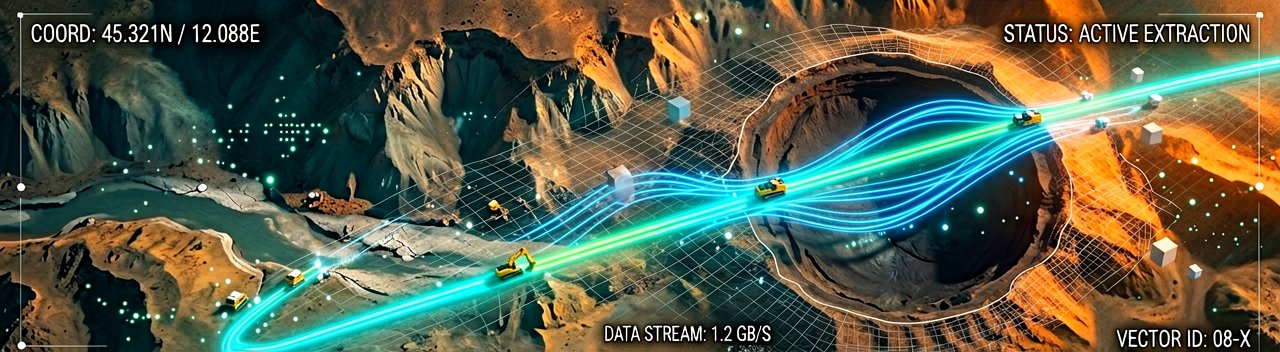
The technological heavy lifting here is being done by what investors describe as a foundational model layer for satellite intelligence. Unlike traditional GIS (Geographic Information System) tools that require specific datasets to be downloaded and processed locally, TerraByte’s engine operates on a stream. This allows for "agentic" search capabilities—where the AI can identify a pattern, such as a specific type of mining equipment, and then autonomously scan historical and real-time feeds to track that equipment’s movement across borders. It is a shift from reactive monitoring to proactive discovery, turning a satellite’s "eye in the sky" into a brain that knows exactly what it’s looking at without being told.
From a stakeholder perspective, the implications are as massive as the datasets themselves. For ESG (Environmental, Social, and Governance) officers, this means real-time verification of supply chain claims, like spotting illegal deforestation in remote regions as it happens. For infrastructure leads, it’s about identifying power-line segments in need of repair or finding the best spots for new EV charging stalls based on actual traffic flow rather than outdated surveys. The backing from firms like Ascend and PSL Ventures highlights a broader market bet: that the future of "smart" anything—cities, farms, or logistics—depends entirely on a computer's ability to read the physical world as accurately as it reads a line of code.
While the Seattle-based TerraByte AI is making waves in the commercial sector, the broader "Terrabyte" ecosystem—including research platforms like the High Performance Data Analytics system operated by the German Aerospace Center (DLR)—points to a global race to dominate Earth Observation. These platforms are converging on a single goal: making global and decadal observations accessible to researchers tackling climate change and resource scarcity. The commercial side, led by startups like Madhok’s, is essentially taking those supercomputing capabilities and wrapping them in a user-friendly API, ensuring that the "industrial era of AI" includes a comprehensive, real-time map of the world we’re building.
Geospatial analysis has long been the playground of well-funded governments and defense contractors, but a stealthy Seattle startup is looking to hand those keys to the rest of us. TerraByte AI officially pulled back the curtain this week on a platform they’re calling an "Earth Search Engine," a tool designed to sift through a relentless firehose of real-time satellite data using natural-language queries. By treating the entire planet as a searchable database, the company aims to move beyond static maps and into a world where pinpointing cargo ships in the Strait of Hormuz or counting empty parking lots across a continent is as easy as typing a sentence.
The core of TerraByte’s pitch is a departure from the "laborious, expensive process of manual annotation" that has historically bottlenecked the industry. Instead of paying thousands of human contractors to draw boxes around cars or rooftops, CEO and Microsoft veteran Rishi Madhok says the platform uses self-supervised learning to "understand the pixels" directly. It’s a classic tech-journalist’s dream: taking a raw, messy resource—in this case, petabytes of orbital imagery—and using a foundational AI layer to make it instantly legible to everyone from urban planners to climate researchers. As detailed by GeekWire, the startup isn't just looking at the "what," but the "where" and "when" at a scale that was previously unthinkable for any single entity without a three-letter acronym in its name.
Behind the Scenes: What most reports miss is the sheer pedigree of the talent steering this ship. Founders Rishi Madhok and Fuxun Yu didn't just stumble into the geospatial sector; they were instrumental in building the scaffolding for it at Microsoft. Madhok previously led geospatial AI initiatives for the Microsoft Planetary Computer, while Yu oversaw the tech giant’s Geospatial Foundational Model project. Their transition from one of the world's largest cloud providers to a lean startup environment suggests a belief that the next leap in location intelligence won't come from a bloated corporate stack, but from a specialized, API-first infrastructure that can be "bolted on" to existing industrial workflows.
The Architecture of Autonomy
The technological heavy lifting here is being done by what investors describe as a foundational model layer for satellite intelligence. Unlike traditional GIS (Geographic Information System) tools that require specific datasets to be downloaded and processed locally, TerraByte’s engine operates on a stream. This allows for "agentic" search capabilities—where the AI can identify a pattern, such as a specific type of mining equipment, and then autonomously scan historical and real-time feeds to track that equipment’s movement across borders. It is a shift from reactive monitoring to proactive discovery, turning a satellite’s "eye in the sky" into a brain that knows exactly what it’s looking at without being told.
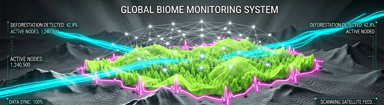
From a stakeholder perspective, the implications are as massive as the datasets themselves. For ESG (Environmental, Social, and Governance) officers, this means real-time verification of supply chain claims, like spotting illegal deforestation in remote regions as it happens. For infrastructure leads, it’s about identifying power-line segments in need of repair or finding the best spots for new EV charging stalls based on actual traffic flow rather than outdated surveys. The backing from firms like Ascend and PSL Ventures highlights a broader market bet: that the future of "smart" anything—cities, farms, or logistics—depends entirely on a computer's ability to read the physical world as accurately as it reads a line of code.
While the Seattle-based TerraByte AI is making waves in the commercial sector, the broader "Terrabyte" ecosystem—including research platforms like the High Performance Data Analytics system operated by the German Aerospace Center (DLR)—points to a global race to dominate Earth Observation. These platforms are converging on a single goal: making global and decadal observations accessible to researchers tackling climate change and resource scarcity. The commercial side, led by startups like Madhok’s, is essentially taking those supercomputing capabilities and wrapping them in a user-friendly API, ensuring that the "industrial era of AI" includes a comprehensive, real-time map of the world we’re building.
Reading Between the Lines: The promise of a "searchable planet" sounds like the ultimate transparency tool, but it rests on a precarious assumption: that the data being searched is actually objective. In reality, satellite imagery is a product of sensor bias, atmospheric interference, and orbit schedules. If TerraByte’s AI hallucinated a car in a parking lot, the error would be trivial; if it misidentifies a methane leak or an illegal fishing vessel, the financial and geopolitical fallout could be catastrophic. We are moving toward a world where "truth" is determined by an algorithm’s interpretation of a pixel, which effectively places a massive amount of power in the hands of the software engineers tuning the model weights.
Furthermore, there is a fundamental contradiction in the democratizing narrative of these AI platforms. While TerraByte aims to make geospatial data accessible to the masses, the high-resolution imagery required to make their insights truly actionable remains locked behind the paywalls of companies like Maxar or Planet. An "Earth Search Engine" is only as good as the library it has access to, and for now, that library is an expensive, walled garden. Unless the cost of the raw pixels drops as fast as the cost of the AI processing them, we risk creating a system where only the affluent can afford to "google" the physical world in high definition.
There is also the matter of "data obesity." We are currently launching satellites faster than we can build the infrastructure to meaningfully interpret their output. TerraByte is stepping into this gap, but the danger is that we replace human oversight with a black box that tells us what to think about the terrain without ever requiring us to look at it ourselves. The convenience of natural-language queries could lead to a superficial understanding of complex geographical phenomena, where "find all floods" yields a list of coordinates but misses the nuanced environmental context that a trained human analyst would immediately flag as a false positive.
The Specter of Absolute Visibility
The privacy implications are equally thorny. Up until now, "security through obscurity" was the default state for most of the planet; most things happening in the middle of a desert or the middle of an ocean simply went unnoticed. By enabling "agentic search," TerraByte effectively ends that era. If an AI can be tasked to "alert me every time a specific person’s private jet lands," the line between industrial intelligence and high-altitude stalking becomes uncomfortably thin. We are building a Panopticon with a search bar, and we haven't quite decided who gets to hold the keyboard.
"We’ve finally reached the point where the satellites can see everything, the AI can understand everything, and yet we still can’t find a decent parking spot on a Saturday night without three apps and a prayer."
Artūras Malašauskas is an AI Systems Integrator with 20+ years of production-grade web engineering experience. He has designed, shipped, and scaled enterprise Python/PHP systems for logistics, SaaS, and public-sector clients. For the past year, he has focused exclusively on AI integrations: deploying open-source LLMs, building generative media pipelines (image, audio, video), and engineering multi-agent workflows for real production environments. His standard: reproducibility, security, cost-efficient inference—no vaporware. He documents and evaluates emerging AI tooling, separating verified capabilities from marketing noise. Technical editor at: muza-ai.eu, ai-verslas.lt, ai-naujinos.lt Connect on LinkedIn
Comments