NASA's AI Flood Detector Is Now Running in Orbit: A New Era for Earth Observation
For decades, Earth observation has followed a somewhat frustrating loop: a satellite captures an image, beams that massive file down to a ground station, and then scientists spend hours or days processing it to find out what happened. But when a river bursts its banks, hours are a luxury that emergency responders simply don't have. NASA is now flipping the script by moving the "thinking" part of the process directly into space.
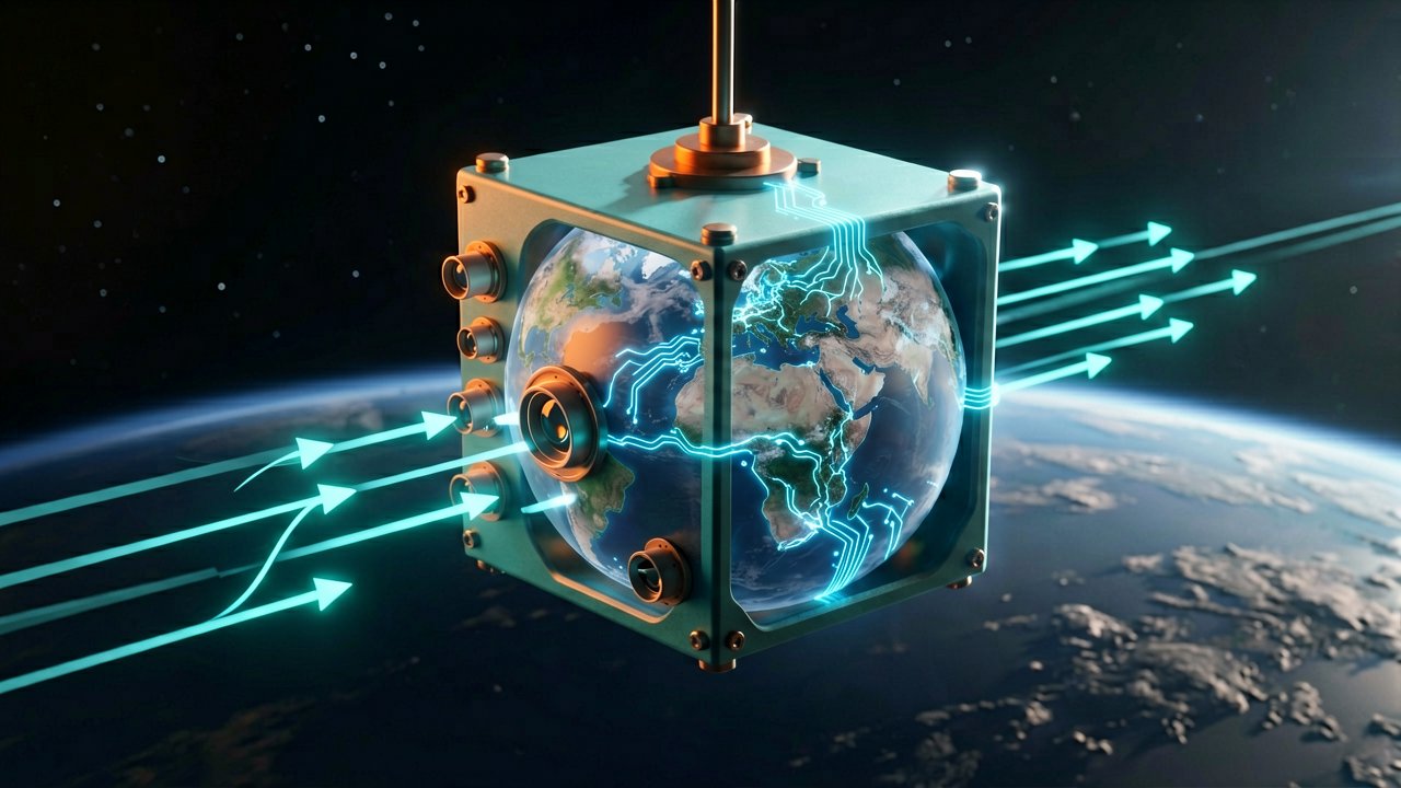
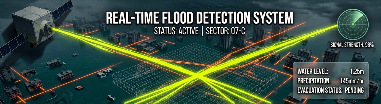
The agency recently announced that its new AI-powered flood detector is officially operational in orbit. This isn't just a software update; it’s a fundamental change in satellite architecture. By running complex machine learning algorithms on board a tiny CubeSat, NASA can now identify floodwaters in real-time, filtering out useless data like cloud cover before the information even hits a terrestrial server.
As reported by NASA Earth Sciences, the mission utilizes a specialized AI chip designed to handle the harsh environment of space while processing high-resolution imagery. This allows the satellite to act as an autonomous scout, sending back only the most critical information—specifically, the coordinates and extent of flood zones—rather than dumping gigabytes of raw pixels.
Breaking the Data Bottleneck
The primary hurdle in satellite-based disaster management has always been the "data bottleneck." Traditional satellites are essentially flying cameras that don't know what they are looking at. They capture everything, but the bandwidth required to send that data to Earth is limited. If a satellite passes over a flooded region but is also looking at 90% cloud cover, it usually sends the whole useless image anyway.

With this new AI integration, the satellite can "decide" what is worth sending. According to NASA JPL, the onboard system uses a neural network trained on thousands of previous flood images to distinguish between permanent water bodies, temporary flooding, and mere shadows or clouds. This efficiency could reduce the time it takes to get actionable data into the hands of rescuers from days to just minutes.
This leap in technology is part of a broader trend known as "edge computing," where data is processed at the source rather than in a centralized cloud. In the context of space, the "edge" is the satellite itself. This reduces the reliance on massive ground-based supercomputers for the initial triage of environmental data, making the entire ecosystem more resilient and responsive.
A Scalable Solution for a Warming Planet
The timing of this deployment couldn't be more critical. As climate change increases the frequency and severity of extreme weather events, the need for rapid monitoring is skyrocketing. Small, low-cost satellites equipped with AI could form a "constellation of eyes" that provide global coverage, ensuring that no flash flood or dam breach goes unnoticed, even in the most remote parts of the world.
Experts at Space.com highlight that this mission serves as a proof of concept for future "smart" constellations. If one satellite detects a burgeoning flood, it could theoretically signal its neighbors to adjust their orbits or sensors to get a better look, creating an autonomous network of disaster-monitoring robots orbiting our planet.
Interestingly, the software used for this mission isn't just a black box; it's designed to be adaptable. Because the AI is software-defined, NASA engineers can retrain the model and upload new versions to the satellite while it’s still in orbit. This means the satellite can "learn" to identify different types of disasters, such as wildfires or volcanic eruptions, without needing a hardware replacement.
The Human Element and Future Horizons
While the AI does the heavy lifting, the ultimate goal is to empower human decision-makers. By providing a "clean" stream of data, the system allows FEMA, the Red Cross, and local governments to visualize the disaster landscape without having to sift through noise. It’s about getting the right map to the right person at the right moment.
Further insights from Phys.org suggest that this technology will eventually integrate with other sensor types, such as radar and thermal imaging. While visual cameras are great, they can't see through heavy storm clouds or at night. Combining AI with Synthetic Aperture Radar (SAR) would create a system that can track floods 24/7, regardless of weather conditions.
As we look forward, the success of this mission paves the way for deeper space exploration as well. If a satellite can autonomously map a flood on Earth, similar systems can map gullies on Mars or ice movements on Europa without waiting for instructions from Earth, which can take over 20 minutes to arrive. The "smart" satellite era has officially begun.
Ultimately, NASA’s AI flood detector is a testament to the power of shrinking technology. What once required a room full of servers can now be done on a device the size of a shoebox. As this technology matures, the way we watch, understand, and protect our planet will be transformed from a series of snapshots into a living, breathing, and intelligent dialogue with the world below.
The Intelligence Behind the Orbit: While the headline focuses on NASA’s successful deployment, the architectural backbone of this mission represents a sophisticated collaboration between government research and private-sector innovation. At the heart of this "orbital brain" is the IMPS (In-SITU Managed Processing System), a hardware-software hybrid designed to thrive where consumer electronics would typically fail. This isn't just about sticking a GPU in a box; it’s about radiation-hardened circuitry that can execute trillions of operations while being bombarded by high-energy particles.
The primary vehicle for this demonstration is a CubeSat, a class of miniaturized satellites that has democratized space access. Unlike the bus-sized satellites of the 1990s that cost billions, these modular units allow NASA’s Earth Science Technology Office (ESTO) to iterate rapidly. By leveraging the CubeSat platform, the team could focus specifically on the AI’s "inference" capabilities—the ability of the model to apply its training to new, unseen data in real-time as it zips over the Earth at 17,000 miles per hour.
A key player in this technological shift is the partnership with commercial chipmakers who are increasingly looking toward the "Space Edge." Companies are now modifying Commercial Off-The-Shelf (COTS) hardware to meet NASA’s stringent power requirements. In a vacuum, heat dissipation is a massive challenge; without air to carry heat away, processors can quickly melt. This mission proves that high-performance AI can run within the tight "power budget" of a small satellite, often operating on less electricity than a standard household LED bulb.
The Training Ground and Neural Architecture
Before the AI ever reached the thermosphere, it underwent a grueling "boot camp" on the ground. Data scientists used decades of historical imagery from the Landsat program and the European Space Agency’s Sentinel missions to teach the algorithm. The challenge wasn't just identifying water, but distinguishing the murky, debris-filled water of a flood from the dark green of a forest canopy or the deep blue of a healthy lake. This required a deep convolutional neural network (CNN) capable of pixel-level classification.
The complexity of this task is magnified by the varied geography of Earth. An AI that recognizes a flood in the flat plains of the American Midwest might struggle with the steep, shadowed valleys of the Himalayas. To combat this, the NASA team implemented a "transfer learning" approach, allowing the model to be fine-tuned for specific regions. This flexibility is what makes the current orbital test so significant; it’s a living system that can be updated as it encounters new environmental "edge cases."
Furthermore, the software environment on the satellite uses a containerized approach, similar to how modern web applications run on Earth. This allows engineers to swap out the "Flood Brain" for a "Fire Brain" or a "Cloud Masking Brain" without rebooting the entire satellite. This modularity is a direct result of NASA’s push toward the New Space economy, where software agility is just as important as hardware durability.
Collaborative Networks and Global Impact
While NASA leads the charge, the implications of this AI detector extend to international partners like the United Nations Platform for Space-based Information for Disaster Management and Emergency Response (UN-SPIDER). These organizations rely on timely data to coordinate international aid. By reducing the "latency" of satellite data—the gap between an event happening and a map being produced—NASA is essentially providing a global early warning system that operates autonomously.
The private sector is also watching closely. Companies like Planet and BlackSky, which operate large constellations of small satellites, stand to benefit from these onboard processing techniques. If private constellations adopt similar AI-driven triage, the volume of useless data beamed down to Earth would plummet, drastically lowering operational costs and freeing up bandwidth for high-priority emergency communications during global crises.
This mission also highlights the role of the Jet Propulsion Laboratory (JPL) in pushing the boundaries of autonomous systems. JPL’s experience with Mars Rovers, which must navigate without real-time human input, provided the philosophical framework for this satellite. Just as a rover must decide which rock is worth a laser sample, this satellite must decide which kilometer of coastline is worth a high-priority data transmission. It is the beginning of a truly "sentient" sensor web.
The Road to Fully Autonomous Earth Science
Looking ahead, the success of this AI flood detector is the first step toward a "Self-Directed Earth Observatory." In this future scenario, a primary satellite might detect a thermal anomaly—a potential wildfire—and automatically task a secondary, higher-resolution satellite to zoom in on the coordinates. All of this would happen without a single human in the loop, saving the critical minutes that determine whether a fire can be contained or becomes a catastrophe.
The integration of AI also addresses the "Big Data" problem in Earth science. We are currently drowning in more satellite imagery than humans can ever hope to analyze. By moving the analysis to the point of capture, NASA is moving from a "collect-it-all" strategy to a "knowledge-first" strategy. We no longer want more pixels; we want more answers. This shift is fundamental to how we will manage Earth's resources in an increasingly volatile climate.
As the mission continues its residency in orbit, it will serve as a floating laboratory for developers and researchers. The data gathered during this phase will inform the next generation of NASA’s Earth System Observatory, a multi-mission program designed to provide a 3D holistic view of Earth. By proving that AI can handle the "triage" of disaster data, NASA has ensured that our future eyes in the sky are not just watching, but truly understanding the world below.
The Intelligence Arbitrage in Low Earth Orbit: From a strategic standpoint, NASA’s deployment of onboard AI isn't just a win for disaster management; it represents a fundamental pivot in the "physics of data." For decades, the space industry has been obsessed with optics—building better mirrors and sharper sensors—but we are now entering an era where the value of a satellite is determined by its "logic-per-pixel." By processing data at the edge, NASA is essentially devaluing the raw image and hyper-valuing the derived insight, a shift that will force every commercial player in the space economy to rethink their data-monetization strategies.
Analytically, this move addresses the "Bandwidth Paradox." As our sensors become more capable of capturing terabytes of data per second, our ability to beam that data back to Earth through the bottleneck of radio frequency (RF) bands remains relatively stagnant. NASA’s AI flood detector solves this not by building a bigger pipe, but by making the data smaller. This "intelligence-first" architecture suggests that future orbital supremacy won't belong to those with the biggest satellites, but to those with the most efficient algorithms capable of operating in low-power, high-radiation environments.
This mission also signals a significant change in the risk-reward calculus of government-funded space programs. Historically, NASA has been risk-averse, favoring "flight-proven" (often decades-old) hardware. By running experimental machine learning on a CubeSat, the agency is embracing the "fail fast" mentality of Silicon Valley. This cultural cross-pollination is critical; it allows the public sector to leverage the rapid advancements in neural network optimization that are currently driving the terrestrial AI boom, applying them to existential threats like climate change.
Market Displacement and the Downstream Economy
The successful automation of flood detection creates a massive ripple effect in the geospatial intelligence (GEOINT) market. Currently, a whole ecosystem of private companies exists solely to process, clean, and analyze satellite imagery for insurance firms and governments. If the satellite itself begins to perform the initial "triage," the middle-tier of the data processing market could face rapid consolidation. The value is moving from the "analysis service" to the "onboard software," potentially turning satellite manufacturers into software-as-a-service (SaaS) providers.
Furthermore, this technology acts as a force multiplier for humanitarian efforts. In the current model, disaster response is often reactive—we see the flood, then we act. With autonomous AI, the response becomes proactive. A satellite that can identify "pre-flood" saturation levels or anomalous river rises can trigger alerts before the water even reaches residential areas. This shift from "monitoring" to "predicting" could save billions in infrastructure damage and, more importantly, countless lives by giving communities an extra 12-to-24-hour lead time.
However, we must also consider the "black box" problem of AI in a mission-critical context. If an onboard algorithm fails to identify a flood because of a "hallucination" or a training bias, the consequences are far more dire than a faulty chatbot response. As we delegate environmental stewardship to orbital algorithms, the need for transparent, explainable AI becomes a matter of international safety. We are essentially trusting a digital brain to be the referee of reality for those on the ground.
Geopolitical Implications of Autonomous Sensing
Beyond the scientific merit, there is a geopolitical dimension to "intelligent" satellites. A satellite that can autonomously decide what is "important" to transmit back to Earth is a satellite that can potentially bypass traditional data interception or censorship. For developing nations that lack their own space infrastructure, these AI-driven alerts provide a level of sovereignty over their disaster preparedness that was previously gated behind expensive, high-latency data contracts with global superpowers.
There is also the question of "Orbital Data Sovereignty." If an American AI detects a flood in a non-allied nation, who owns that insight? The speed of onboard processing creates a "first-mover advantage" in disaster diplomacy. The nation that has the smartest satellites will likely be the first to offer aid, essentially using algorithmic speed as a tool of soft power. In this sense, the AI flood detector is as much a diplomatic instrument as it is a scientific one.
The environmental footprint of space data centers is another analytical angle often overlooked. Terrestrial data centers consume vast amounts of water and electricity. By shifting the heavy lifting of initial processing to solar-powered satellites, NASA is inadvertently creating a more sustainable model for "Big Data." While the energy savings are currently small, at the scale of a 1,000-satellite constellation, the carbon offset of not having to process trillions of useless "cloud-only" images on Earth becomes substantial.
The Convergence of Space and Silicon
We are witnessing the death of the "dumb" satellite. In the coming decade, an Earth observation satellite without onboard AI will be as obsolete as a flip phone in the age of the smartphone. The convergence of aerospace engineering and deep learning is creating a new discipline: "Orbital Informatics." This field will be less about the mechanics of gravity and more about the logistics of latency and the optimization of neural weights for zero-G environments.
The ultimate metric of success for this NASA mission isn't just that it found water; it's that it proved a satellite could think for itself and get it right. As we continue to deploy these intelligent sensors, the Earth will effectively gain a "digital nervous system"—an automated layer of awareness that can sense, interpret, and report on its own health. This isn't just about floods; it's about the planet finally having a way to tap us on the shoulder and say, "Hey, you might want to look at this."
As we move forward, the challenge will be to ensure that this "intelligence" remains a shared global asset. The democratization of orbital AI could lead to a golden age of environmental transparency, where it becomes impossible to hide illegal deforestation, massive methane leaks, or burgeoning humanitarian crises. The eye in the sky is no longer just watching; it’s finally starting to understand exactly what it sees, and it’s not waiting for our permission to tell us the truth.
"We’ve finally taught satellites to stop sending us 4K pictures of clouds when we asked for a flood report. It turns out that even in the vastness of space, the most valuable thing you can launch isn't a bigger lens, but a little bit of common sense—and luckily for us, the AI doesn't mind the lack of legroom."
Artūras Malašauskas is an AI Systems Integrator with 20+ years of production-grade web engineering experience. He has designed, shipped, and scaled enterprise Python/PHP systems for logistics, SaaS, and public-sector clients. For the past year, he has focused exclusively on AI integrations: deploying open-source LLMs, building generative media pipelines (image, audio, video), and engineering multi-agent workflows for real production environments. His standard: reproducibility, security, cost-efficient inference—no vaporware. He documents and evaluates emerging AI tooling, separating verified capabilities from marketing noise. Technical editor at: muza-ai.eu, ai-verslas.lt, ai-naujinos.lt Connect on LinkedIn
Comments